The National Weather Service storm survey team says at least two EF-1 tornadoes touched down Saturday morning in Christian County.
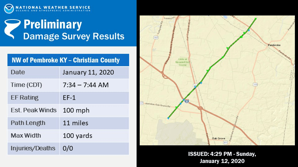
The storm survey indicates the first tornado touched down around 7:34 Northwest of Pembroke, had peak winds of 100 miles per hour and remained on the ground for 11 miles. The tornado had a maximum width of 100 yards and remained on the ground for 10 minutes. It left a path of damage from Kentucky 117 just south of the Flying J truck stop to just north of the CSX Rail Yard off John Rivers Road.
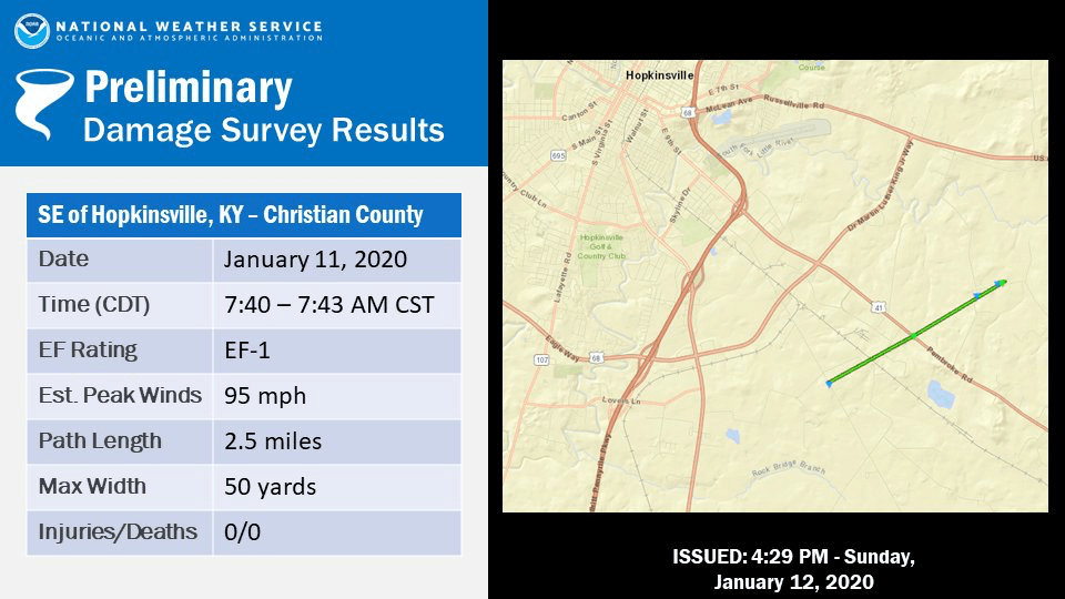
The second tornado touched down around 7:40 Southeast of Hopkinsville, had peak winds of 95 miles hour and stayed on the ground for 2.5 miles. The tornado had a width of 50 yards and stayed on the ground for about three minutes. It left a path of damage from just east of the Casky Rail Yard to Northwest of the Pembroke Road.
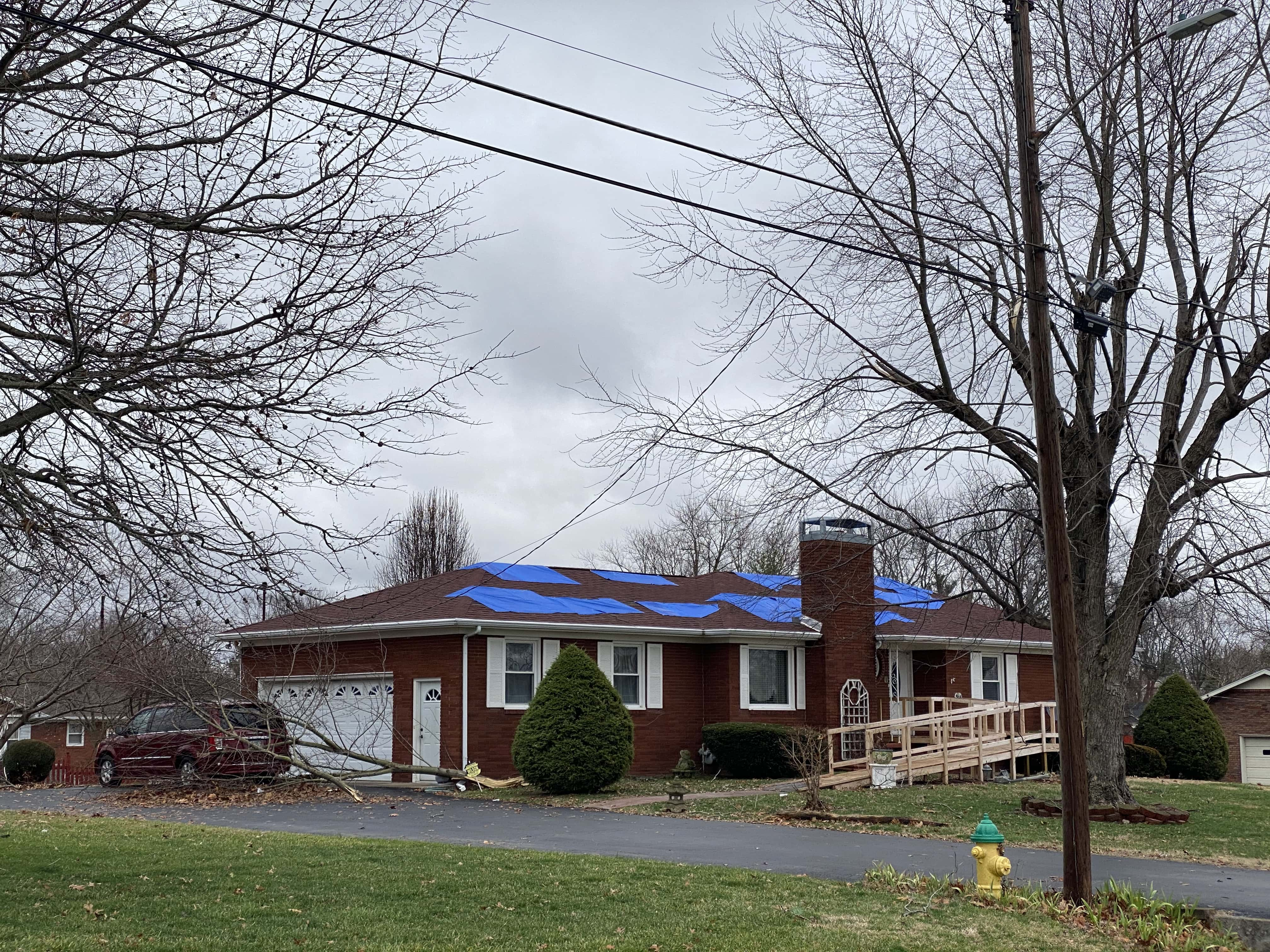
No official determination has been released concerning what caused the damage on the Northwest side of Hopkinsville.
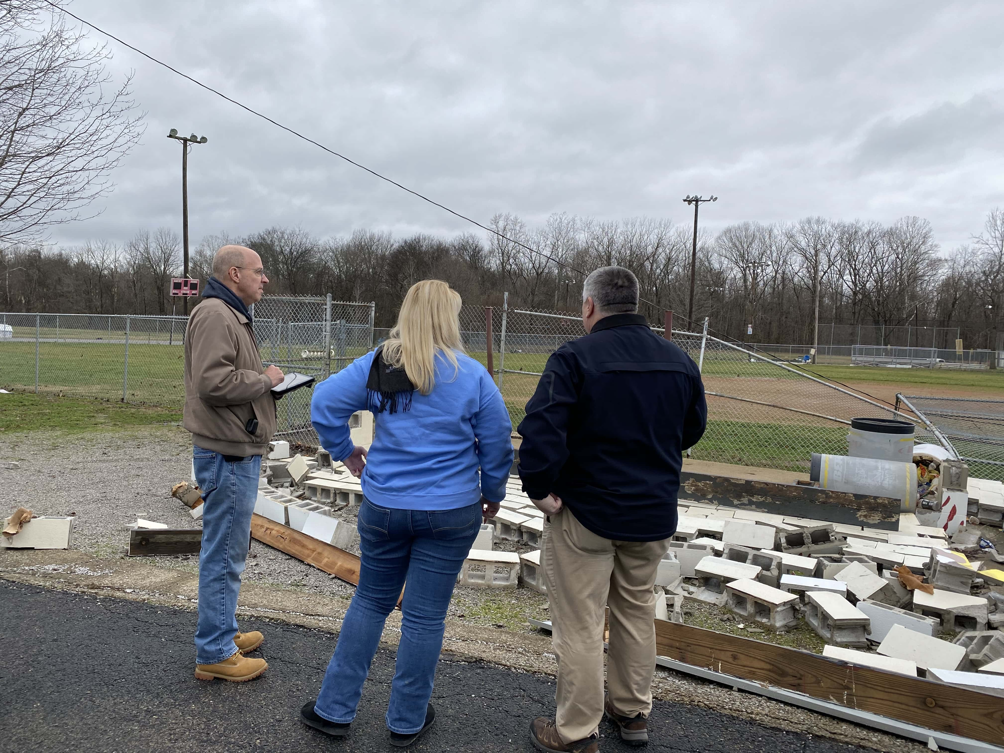
National Weather Service Science Officer Pat Spoden told the News Edge Sunday he and forecaster Christine Wielgos are looking a number of factors related to the damage.
Spoden and Wielgos, Christian County Emergency Director Randy Graham and a team from the Christian County Weather Spotters inspected damage at the Christian County Senior Citizens Center, Christian County High School and baseball field, the Christian County Schools bus garage, Ruff Park, the neighborhoods near University Heights and Talbert Drive, the CSX rail yard at Casky and the Leavell Farm in south Christian County.
Spoden says a number of factors are considered when making a determination about a severe storm or tornado.
He adds Western Kentucky also received a significant amount of rain during and after the line of storms moved through Saturday morning.
Spoden adds they will be busy this week conducting storm surveys in Christian, Trigg , Caldwell and other counties that sustained damage Saturday.