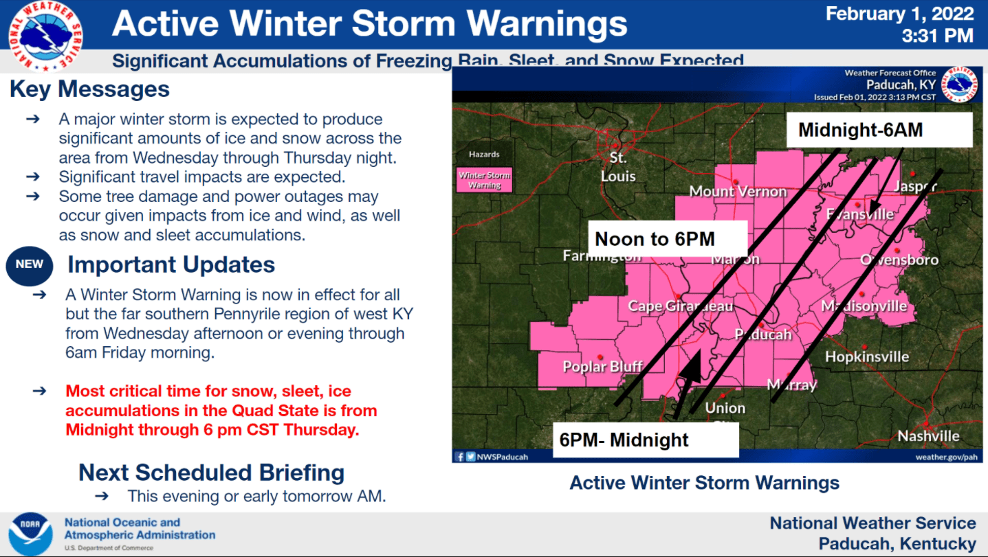
The National Weather Service has issued a winter storm warning for some counties in western Kentucky from Thursday morning at 6 until Friday morning at 6.
Counties included in the winter storm warning are Caldwell, Lyon, Hopkins, Marshall, Calloway, and Muhlenberg. Counties southeast of the line of where rain is expected to switch to sleet and ice are not included in the warning. They are Trigg, Christian, and Todd counties.
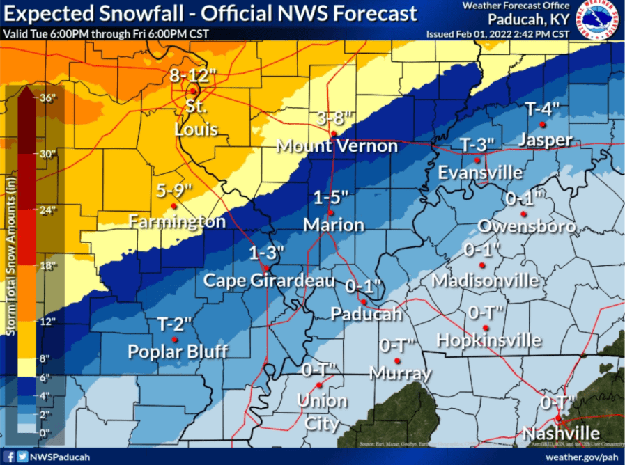
Rainfall Wednesday could total an inch or two ahead of colder air Wednesday night, into Thursday, and then Thursday afternoon.
Weather forecaster Andy Lesage with the National Weather Service in Paducah said during a Tuesday afternoon conference call that ice and sleet are expected with the storm.
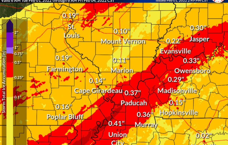
click to download audioLesage said Lyon County and Caldwell County could see three-tenths to fourth-tenths of an inch of ice. Cadiz and Hopkinsville could see ice amounts totaling just 1 to 2 tenths.
Lesage said the heaviest concentration of ice and sleet will be along the Ohio River.
click to download audioWarning Coordination Meteorologist Christine Wielgos said Trigg, Christian, and Todd counties aren’t under a watch or warning but joined Lesage in saying that could change if the system moves to the southeast.
click to download audioForecasters said it could be Sunday before temperatures consistently rise above freezing to melt any precipitation that remains on the ground.
If closings and cancellations occur with this winter storm system, they can be found on our websites as they come in.