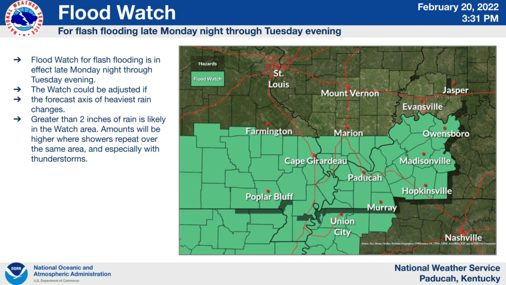
The National Weather Service has issued an aerial flood watch that will be in effect from midnight Monday night until midnight Tuesday night.
The National Weather Service says flash flooding caused by excessive rainfall is possible across Western Kentucky between Monday night and Tuesday night. Excessive runoff may also result in the flooding of rivers, creeks, streams, and other low-lying and flood prone locations.
Rainfall in excess of two inches is expected across Western Kentucky, with some areas to possibly receive more than three inches of rain.
Forecasters say another round of heavy rain could impact the area Wednesday night into Thursday which could produce more flooding problems.
The Weather Edge will continue to monitor the forecast and provide updates as needed.