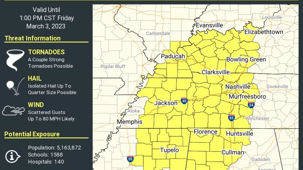
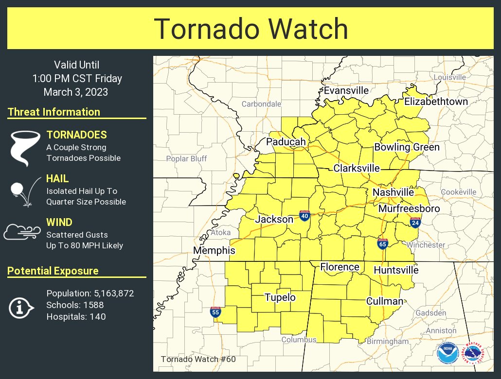
The National Weather Service has issued a Tornado Watch for all of Western Kentucky. The watch remains in effect until 1:00 Friday afternoon.
The National Weather Service has also issued a Wind Advisory that remains in effect until 9:00 PM.
And Trigg, Caldwell, Calloway, Lyon, Crittenden, Livingston, and Marshall Counties are under a Flash Flood Warning until Noon.
Some of the lowest barometric pressure readings could be reached Friday, as severe weather and flooding remain a big concern throughout the morning hours.
Barometric pressure is the measurement of air pressure in the atmosphere. The lower the number, the worse weather conditions can become.
Chris Noles, Science and Operations Officer at the National Weather Service in Paducah, says one of the biggest threats of the low-pressure system tracking through our region is the increased chances for flooding, damaging winds, and brief spin-up tornadoes.
click to download audioThe severe threat for our region will occur between 7 AM and Noon Friday, with flooding threat will in the hours before. Friday’s Wind Advisory has been issued for non-thunderstorm winds.
click to download audioRainfall totals will range anywhere from 2-6” across western Kentucky Friday.
Your Weather Edge will keep you informed online and on-air with WKDZ, WHVO, and WPKY.