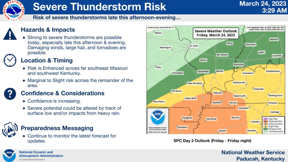

The Storm Prediction Center has placed our region under an enhanced risk for severe weather Friday afternoon into early Saturday morning.
Weather Edge forecaster David Powell says the main threat for severe weather could be early Saturday morning as a cold front moves through. That threat could include damaging winds, large hail, and isolated tornadoes.
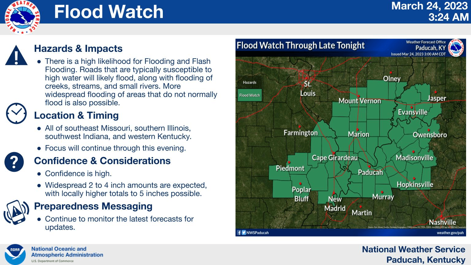
Another concern with this system is flooding. A Flood Watch is in effect until 1:00 Saturday morning, with two to four inches of rainfall expected with higher amounts possible.
Excessive runoff is expected to result in the flooding of rivers, creeks, streams, and other low-lying and flood-prone locations. Creeks and streams may rise out of their banks.
After the front moves through, we will have a chance to dry out before another front moves in early next week bringing additional rainfall and cooler temperatures.
Stay tuned to Edge Media Group radio stations for the latest weather information.
Sign up for Your Weather Edge text alerts by clicking here!