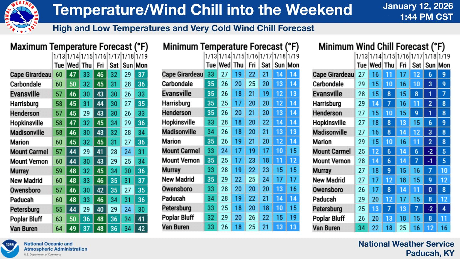
Temperatures in the 50s on Tuesday will give way to the first of two cold fronts to move through the area Tuesday night into Wednesday.
Wednesday’s weather will feature temperatures in the 40s, with a slight chance of rain. However, Wednesday night, the temps will drop below freezing, with Thursday’s high maybe hitting 32 degrees.
Keith Cooley, a lead forecaster with the National Weather Service, says the precipitation this week should mostly be rain or snow flurries with little to no impact.
click to download audioHe says Friday should warm into the mid-40s before a return to the freezer on Saturday.
click to download audioWhile Cooley says the weather models forecasters use are showing little to no snow this week, they are looking fairly accurate for below-freezing weather to begin next week.
click to download audioCooley says some good news is on the way for the 7- to 10-day extended forecast, which should return to normal.
click to download audioWhile most people are focused on rain and low temperatures this week, Cooley says the lack of substantial rain over the past few weeks has kept most of western Kentucky in the Abnormally Dry drought category with no immediate relief in sight.
click to download audioCooley says only a quarter-inch of rain is expected with the fronts this week, keeping the area well-below normal for the first two weeks of January. In each of the past four years, the first two weeks have produced between two and four inches of rain. Through 12 days of this month, less than four-tenths have been recorded.